|
Other Antarctica Pages:
Antarctic Photos
Reference for History of Antarctica
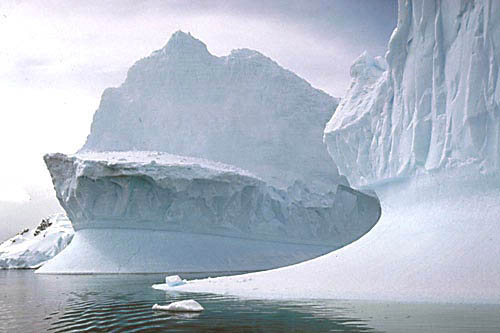
Icebergs:
Antarctic Icebergs
Icebergs of Chile
x
The Antarctic Environment
x
Antarctica is the highest, windiest (katabatic winds), coldest and most
arid continent on earth. It has an average elevation of 2250 meters. The
highest point is the 5140m Vinson Massif. Katabatic winds, driven by
temperature and gravity, originate at higher elevations centrally and flow
to the coast at high velocities. About 98% of the continent is covered in
ice, and this represents 90% of the world's ice - 30 million cubic km or
around 70% of the world's fresh water. Ice averages 2160 meters (6700 ft)
thick and in areas reaches 4700m (14,000ft) in depth. Volcanism is found
on Deception Island along the Antarctic Peninsula and isolated areas of
West Antarctica. Plant species in Antarctica are mostly small simple
life-forms, like algae, lichen and moss. In contrast, the subantarctic
islands support a much wider variety of flora. The largest of the endemic
land-based animal species is a wingless midge (Belgica antarctica) that
grows to just over a centimeter. The rest, all invertebrates, are even
smaller. About 45 bird species breed south of the Antarctica Convergence,
and just a few of those, mostly penguins and petrels, on the Antarctic
continent itself. The Southern Ocean, by contrast, teems with life and
supports vast numbers of fish, seal, whale and seabird species.
Statistics
Name
Antarctica
Area
14.25 million sq km. About 1.5 the area of the USA and second smallest
continent (after Australia).
Non-tourist Population
about 1200 in winter
Coastline
17,968 km
Ice Content
90% of the world's ice - 30 million cubic km or around 70% of the world's
fresh water.
Elevation
lowest point -- Indian Ocean 0 m
highest point -- Vinson Massif 5,140 meters (16,860 feet)
Government
Antarctic Treaty, 1961
Points of Interest
The Lemaire Channel
The Lemaire Channel is a spectacular sight with enormous sheer cliffs
falling straight into the sea. It's a narrow channel flanked by the
Antarctic Peninsula on one side and Booth Island on the other. So
photogenic is the channel that it is sometimes called "Kodak Gap". At the
northern end of the Lemaire Channel are a pair of tall, rounded
snow-capped peaks known as Una's Tits. The channel was first navigated by
Belgian explorer de Gerlach during his 1898 expedition aboard
Belgica. It was
somehow named after another
Belgian explorer -- Charles Lemaire, who explored parts of the Congo.
Paradise (Bay) Harbor
Paradise Bay (see Antarctic Photos and Iceberg pages), off the
Antarctic Peninsula, is one of continents most visited areas. I saw it
from a small inflatable boat called a zodiac that motored around the
icebergs that calve off the glaciers at the harbor's head. The icebergs
and mountains reflect beautifully in the calm water. This serene scene was
the highlight of my trip.
Deception Island
An island of the South Shetland group, Deception Island is easily
recognized on a map by its horseshoe shape. Its collapsed volcanic caldera
is breached at Neptune's Bellows and makes for one of the world's safest natural harbors despite the volcano's periodic eruptions. Ships enter the
relatively calm waters of Port Forster (12km wide) through the caldera's
breach that is surrounded by snow-covered hills that reach 580 meters. The
volcano is still active and its eruptions have caused considerable damage
to past stations located on it. The most recent eruption was in 1991-92. A
curiosity to the Antarctic tourist is the volcanic activity that heats the
waters of Pendulum Cove (so-called because of the British pendulum and
magnetism experiments held there last century). It is so warm that you can
safely swim here. There are large colonies of chinstrap penguins on the
coast, but few other marine animals.
|