|
Michael A. Stecker
masmd@sbcglobal.net
Places Index
Alaska
Albuquerque balloons
American Samoa
Antarctica
Astronomical Sites
Australia
Austria Bryce
Capital Reef
Chile Egypt
England Great Sand Dunes NM
icebergs
Israel
Monument Valley
Nepal
New England's autumn leaves
New Zealand
scenic treasures
Switzerland
Tahiti
Thailand Western Samoa
Yosemite in Spring
Yosemite in Winter
Slide Show
Photo Album
Bryce Canyon National
Park
Introduction
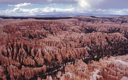
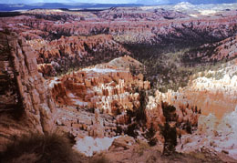
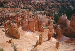
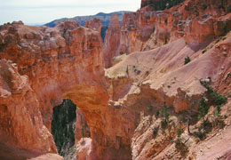
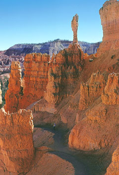
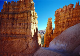
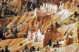
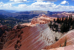
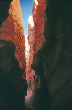
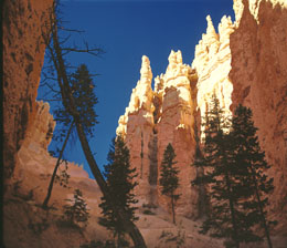
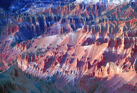
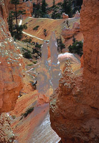
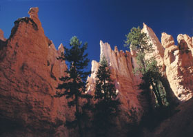
Bryce Canyon National Park in southwestern Utah is named for a series of
horseshoe-shaped amphitheaters carved from the eastern edge of the
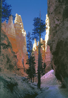
Paunsaugunt Plateau. Colorful red, brown, pink and white cliffs and spires
called hoodoos are the parks most prominent and aesthetically appealing
features.
Geology
During the Cretaceous Period (starting about 144 million years ago) a
great inland seaway extended over much of south central and western USA
into the area now occupied by Bryce Canyon. Over a 60 million year period
it depositing sediments that eventually became the sedimentary rocks of
the region -- the brown and gray marine rocks now exposed at the park's
lowest elevations and across the Paria Valley. Then, in the Tertiary
Period (66 - 40 million years ago) highlands to the west eroded into
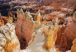
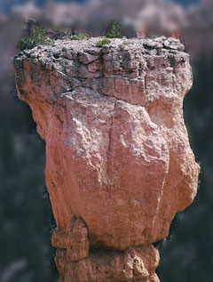
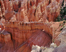
shallow, broad basins. Iron-rich calcific sediments were deposited in the
beds of a series of lakes and streams. These became the reddish rocks of
the Claron Formation from which the hoodoos (pillar of rock, usually of
fantastic shape) are carved. About ten million years ago forces within the
Earth erupted creating the massive uplifts of the Aquarius and Paunsaugunt
plateaus. Rock layers on the Aquarius now tower 2,000 feet above the same
layers of the Paunsaugunt. Consequently, older Cretaceous layers now
rested side by side with younger Tertiary layers across fault lines.
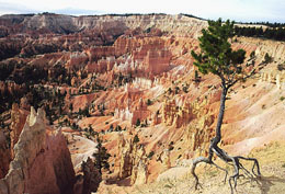
Ancient rivers then carved the tops and exposed edges of these blocks,
removing some layers and sculpting intricate formations in others. The
Paria Valley was created and later widened between the plateaus.
History
The Paiute indians are the indigenous people of the Bryce Canyon region.
The first Euro-Americans to explore the area were Capt. Clarence E. Dutton
and John Wesley Powell in the 1870s. Many of today's place names come from
this time. Other names like Paunsaugunt (home of the beavers), Paria
(muddy water), Panguitch (water or fish) and Yovimpa (point of pines) were
derived from the Paiute language. The Paiutes were soon displaced by
emissaries of the LDS Church (Mormons). Prime among them was Ebenezer
Bryce for whom the canyon was named. In 1923 President Warren G. Harding
proclaimed part of the area as Bryce Canyon National Monument under the
Powell (now Dixie) National Forest. In 1924 legislation was passed to
establish the area as Utah National Park. In 1928 its name was changed to
Bryce Canyon National Park
|